
Home / Route
Official 2027 route
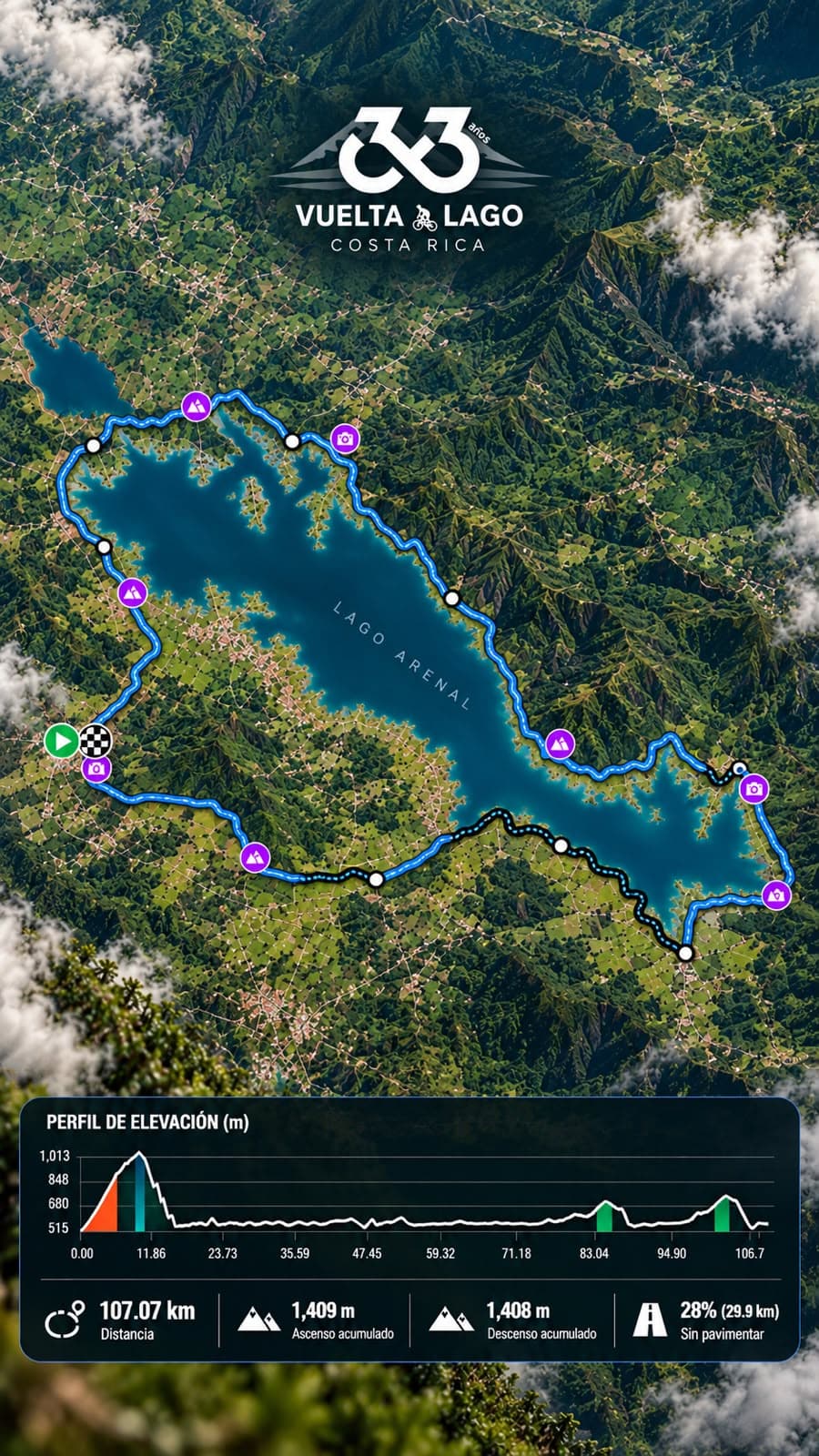
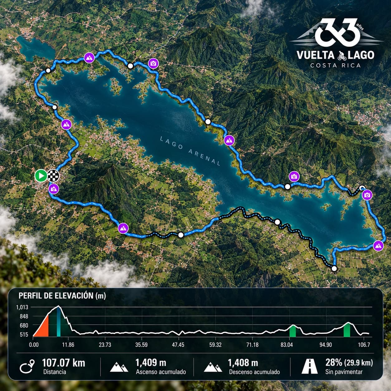
107.07 km around Lake Arenal
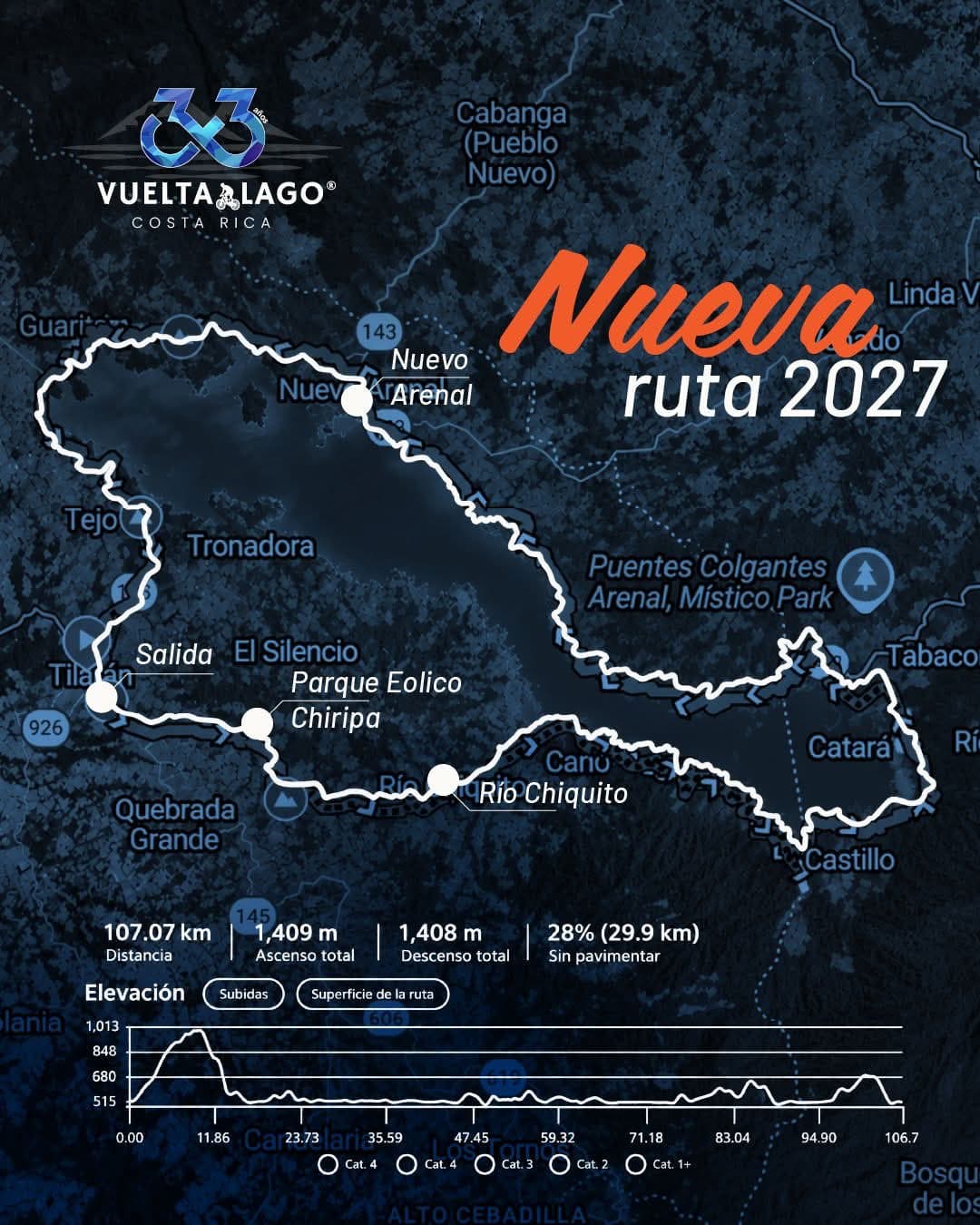
Start and finish in Tilarán, through the Wind Farm, Río Chiquito, the Lake Arenal dam and Nuevo Arenal.
The route
- 1Start — Tilarán
- 2Wind Farm / Finca ChiripaNew section · km 5.5 to 8.7 · private land, mostly uphill
- 3Río Chiquito
- 4Lake Arenal dam
- 5Nuevo Arenal
- 6Finish — Tilarán park
Route details
| Distance | 107.07 km |
|---|---|
| Total ascent | 1,409 m |
| Total descent | 1,408 m |
| Unpaved | 28% (29.9 km) |
| New section | Wind Farm / Finca Chiripa, km 5.5 to 8.7 |
| Starts | 2 — Picones (fast riders) and Recreational |
| Categories | MTB, E-Bike, Hybrid, Gravel and Road |
New in 2027
Wind Farm / Finca Chiripa
From km 5.5 to 8.7, for the first time in the event's history, the route crosses this private land, mostly uphill, on internal roads. It reaches the high parts of the Tilarán mountain range, with wide views, and from there continues toward Río Chiquito.
This section is possible thanks to the owners of MuriMarti S.A. and Ecoenergía. Thank you for opening your doors to us!
Picones
First start, for fast riders.
Recreational
Second start, for recreational riders and the whole family.
Route video
Coming soon: we'll share a video of the route shortly.